
An illustrated journey along New Zealand’s spectacular Southern Scenic Route ending in a two night voyage in Fiordland National Park’s Doubtful Sound: Patea, the Place of Silence.
To view galleries and photos enlarged, click on them
The Southern Scenic Route (SSR) rewards the traveller with epic New Zealand scenery. It runs from Dunedin westwards through the Catlins across the length of the navigable coastline along the bottom of the South Island, before taking a sharp right turn up to Fiordland, ending in Queenstown. It’s the Kiwi road trip you really need to take.
It’s often missed off domestic road trips and the itineraries of international visitors in favour of Aotearoa’s more hyped and famous attractions. But it’s something you can easily do. Back to front if you like. It makes no difference.
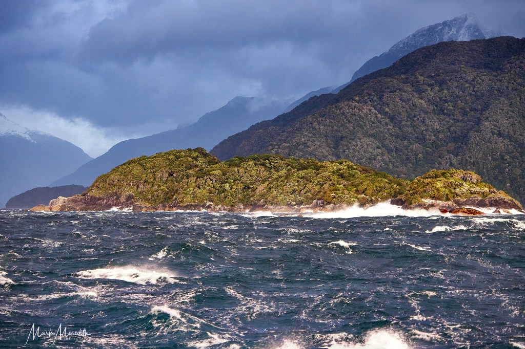
The SSR’s superlative scenic brew of craggy landscapes shaped by roaring southerly gales and relentless seas sweeping up from the Southern Ocean have sculpted the coastline into a series of cliffs, caves, rocks stacks and empty, wide sand beaches nestled between windswept headlands where lighthouses paint the inky blackness.


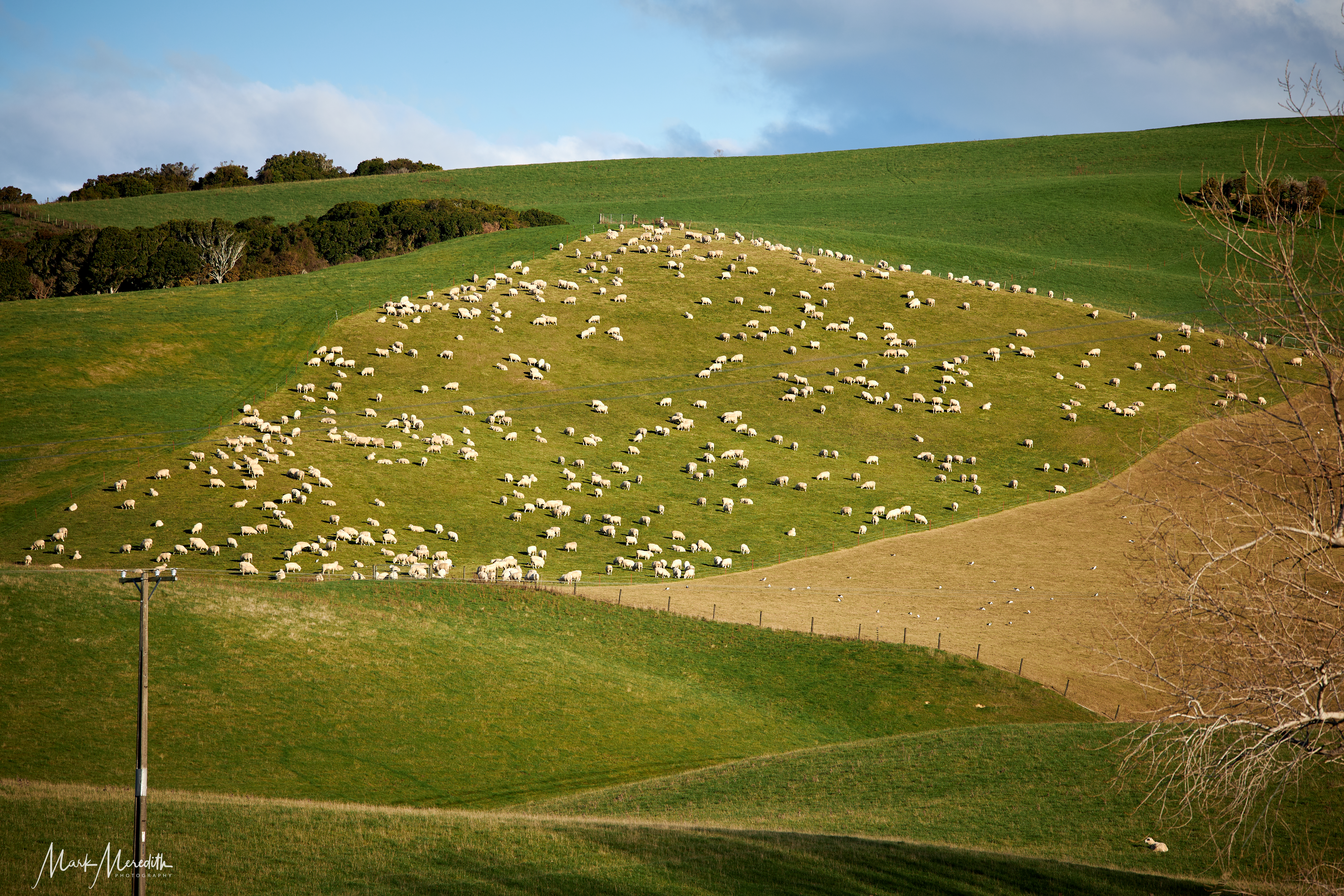
Lonely rural settlements, once a hive of activity during the height of the timber milling industry of the previous two centuries, are sparsely dotted amidst picture book farmland which rolls over hilly countryside amidst the expanse of Catlins Forest Park, where you will find some of the prettiest waterfalls in New Zealand.
Above all, the Catlins, and the vast wilderness of Southern Fiordland westwards, make the SSR a route to take your time over and savour. A campervan trip would be ideal, time on your hands, speed dial turned way down, slowing to let what little traffic builds behind you to pass, soaking in the silence and enormous night sky; basking in that privileged feeling of knowing you are staring out towards over the sea to the ends of the earth. Almost.
Roslyn and I were looking for history, wildlife and dramatic scenery away from the crowds. So we chose eight days in midwinter during term time. No campervan this time, just the manoeuvrability of a small Toyota with barely enough boot space for one suitcase and a shopping bag of essentials.
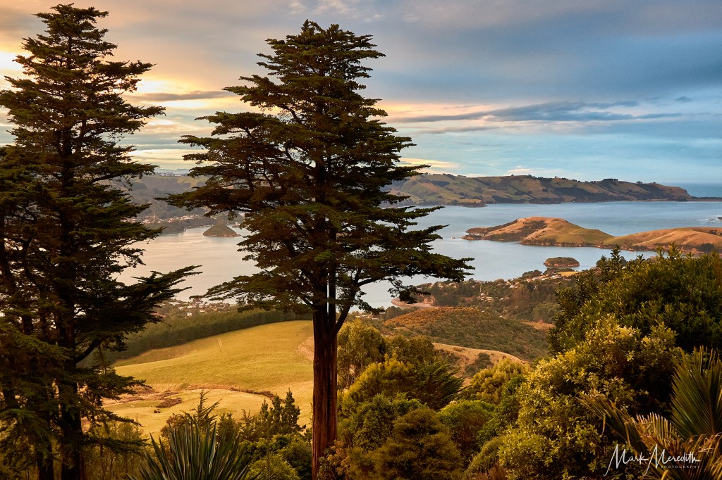
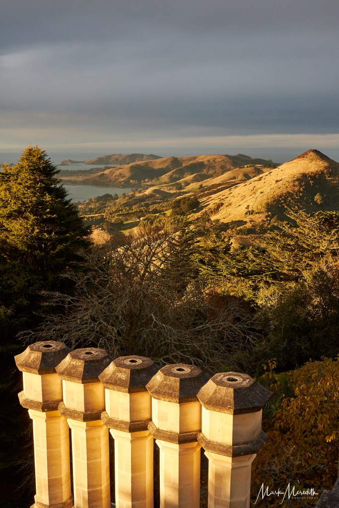
Our adventure along the SSR was bookended by the Otago Peninsula at Dunedin, staying in “New Zealand’s only castle”, Larnach, ending in a two night winter cruise on Fiordland’s Doubtful Sound: Patea.


The advantage of winter is more accommodation options, solitude, and that winter light at the bottom of the world promises memorable photographic opportunities at any time of day.
Importantly, there was the virtual guarantee of seeing large mammals that were not sheep, cattle or would-be venison, up close. Sea lions were a certainty, even elephant seals could be seen, also rare penguins, and any number of seabirds; a seabird hotspot, you could say. But, apart from the impressive variety of seagulls and terns, it seemed that all the other creatures plastered over every website and guide to the SSR had gone on holiday when we were on holiday.
In the Catlins we kept bumping into two women who turned out to be sisters from the North Island gauging the region’s prospects: “We heard venison farmers make most money,” they laughed. I asked if they had seen any seals, even a penguin. “No! You too?” They exclaimed.
Trundling along the SSR the feeling of solitude and quiet is inescapable. There is only the gateway of Balclutha sitting the on mighty Clutha River – where you should stock up on supplies, given shopping is not a Catlins strong point – the city of Invercargill, Bluff, and Riverton near the edge of southern Fiordland, where there is any significant human presence.
Maori settlement of The Catlins (after the Catlins River which was named for a whaling captain called Edward Cattlin, whose name was misspelt) seems to have taken place around 1350. Maori flourished here, feasting on the now extinct, flightless giant moa, but by 1700 had largely moved on, to be supplanted by whalers and sealers.
By the 1840s boatloads of loggers arrived lured by the huge podocarp forests. Land was cleared and sawmills set up which supplied Dunedin with much of its timber. By 1872 more wood was exported from the Catlins than anywhere in New Zealand. A railway line from Balclutha to Owaka was completed in 1879 hastening the efficiency of timber extraction.

Today, the Catlins Coastal Rainforest Park, north of Papatowai and Waikawa, comprise what is left of this once vast, unspoiled wilderness. The forested area is still considerable, and you can explore much of it on well managed Department of Conservation tracks meandering beneath towering rimu, rata, kamhai and silver beech.
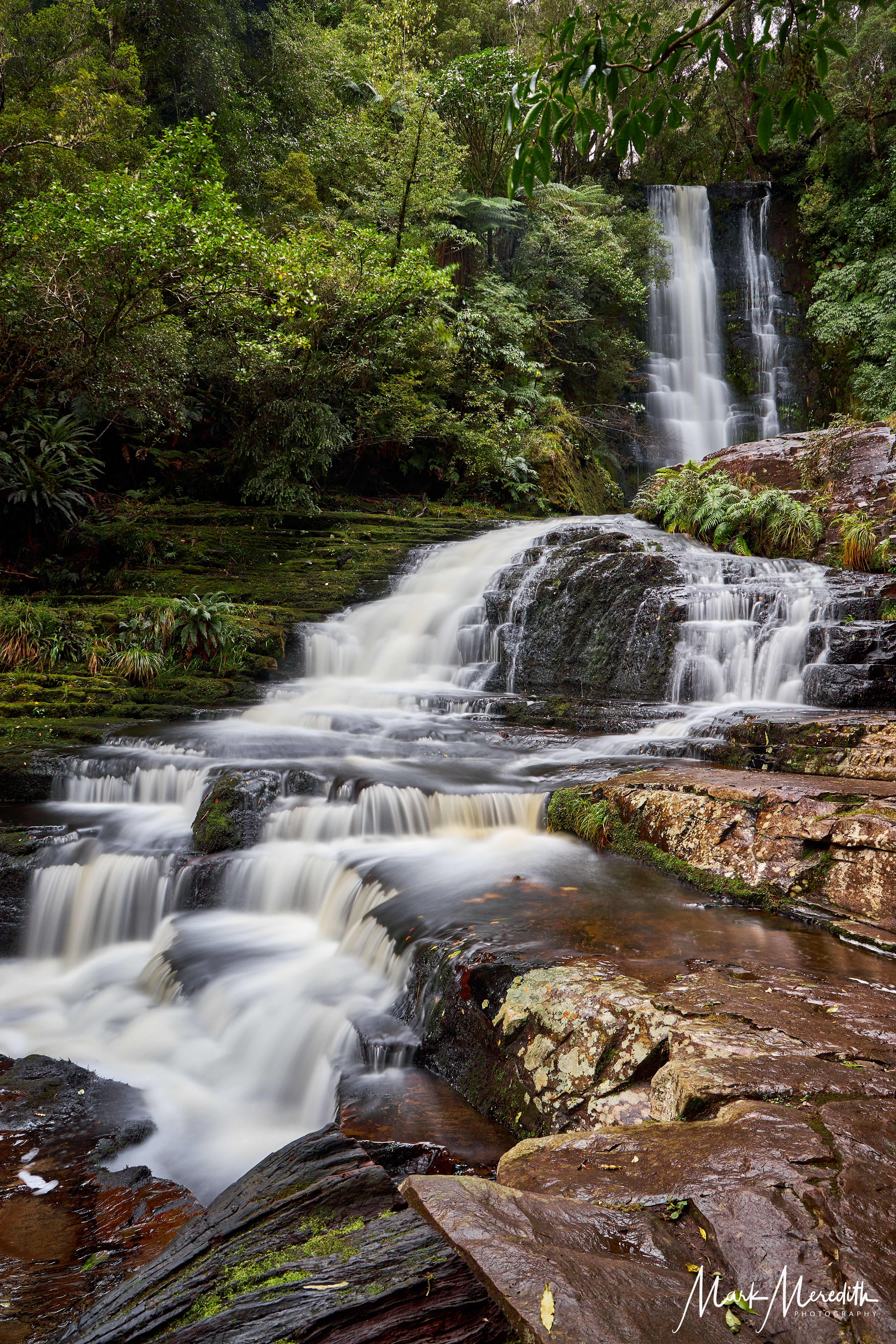
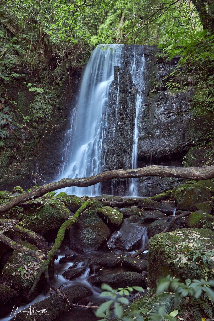
Primeval is the description that most springs to mind walking through the moss covered, dripping rainforest, under giant tree ferns and blistering red bark of fuchsia limbs, following the sound of water to an inevitable cascade. The lovely waterfalls of Purakaunui and McLean cascade down multiple levels and are a photographer’s dream.
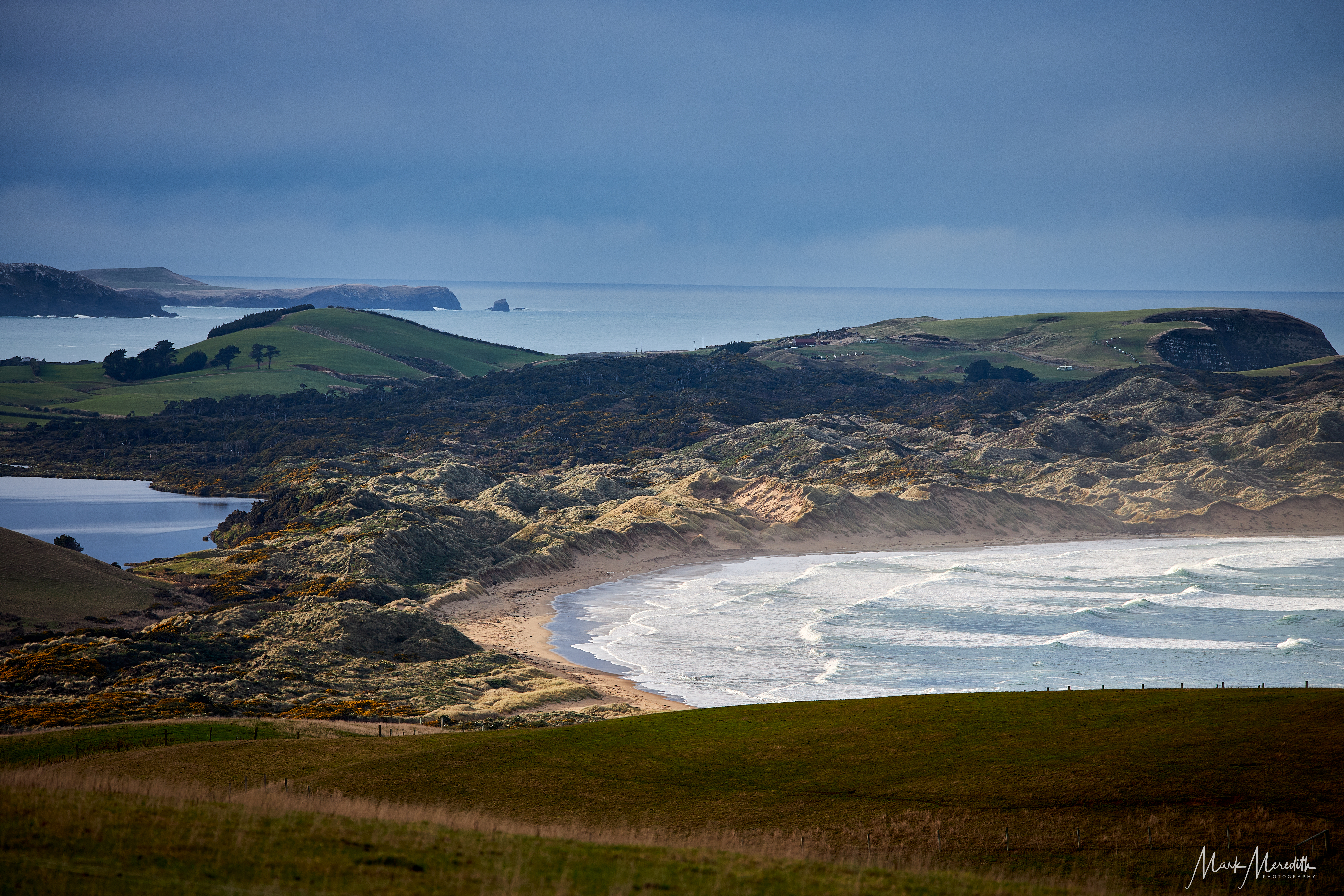
But before you reach Purakaunui Falls the inevitable first Catlins stop heading west will be at Nugget Point and lighthouse. We stayed just east of the iconic lighthouse at Kaka Point which has a large beach and a good number of self catering options.
Nugget Point, the face of any number of Catlins and southern New Zealand travel brochures doesn’t disappoint. It’s reached via a track cut into the hillside. On your left, as you pass out of tunnels of windblown manuka, the unguarded cliffside path drops away steeply to the sea churning over rocks far below. A narrow fenced track leads up to the old lighthouse. It was built in 1870 and is now automated, but the light’s lens remains the original.
It’s the lighthouse’s dramatic placement on a narrow hilly promontory looking out over a series of conical rocks, the nuggets, poking out of the sea as though scattered by the sweep of a giant hand eons ago, that sets it apart and makes it a favourite of photographers. At sunset the last rays of sun strike the nuggets; fiery orange teeth glowing on a darkening sea. The dawn shot is altogether more tricky as the sun rises straight into your camera lens. So I gave it a miss and grabbed an extra few hours kip.


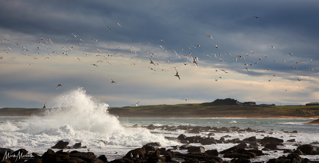
Beneath the lighthouse, if you are lucky, unlike us, you can see southern fur seals sprawled honking on the rocks below. From October to March New Zealand’s only mainland breeding colony of elephant seals will hopefully turn up for you. There’s a sign designating Nugget Point a “no drone zone”, so as not to interfere with the three species of shags, the gannets and spoonbills which wheel overhead.
Meandering westwards past Kaka Point the winding highway gives you options to divert south to bays and beaches with a hinted history: Cannibal Bay – what happened there? And Jacks Blowhole, Roaring Bay, and Surat Bay, named for a ship wrecked there in 1874.


Heading inland will take you to what is possibly the most beautiful and photographed waterfall in all Aotearoa. It’s an easy walk to Purakaunui Falls where, some of the way down a forested hillside, a cascade flows over multiple ledges, like an extravagant silky staircase, into a clearing in the trees where the water runs beneath your viewing platform to an unseen destination.

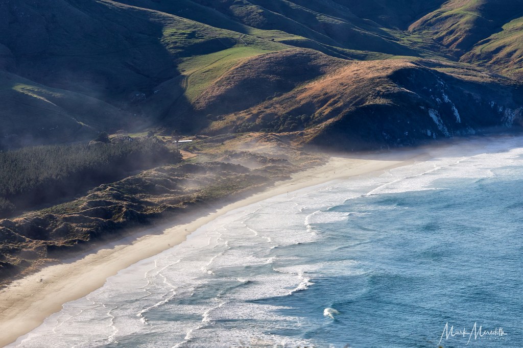
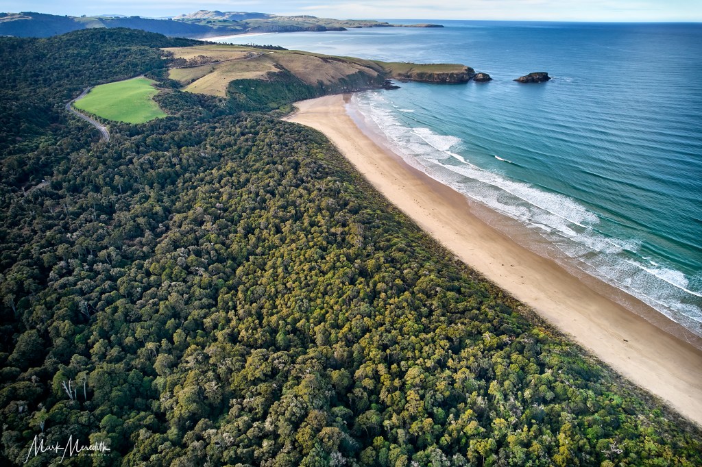
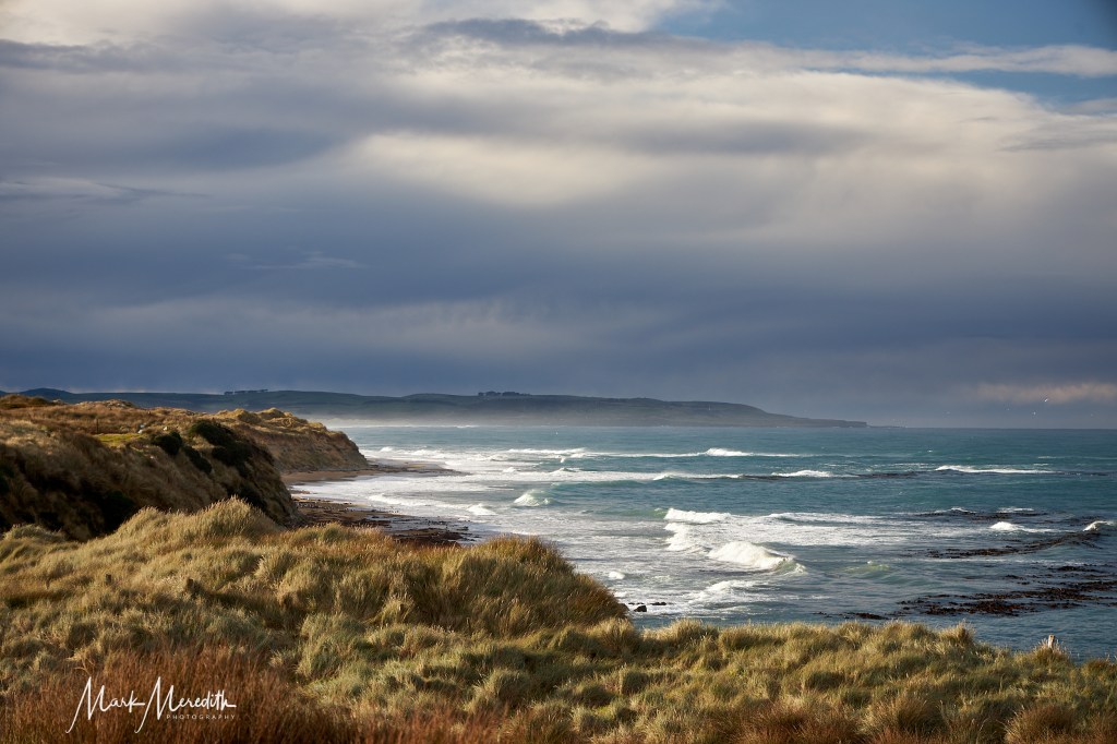
The unspoiled loveliness of the Catlins reaches its zenith at Tautuku Bay where a broad expanse of coastal forest is brought to halt by a long sweeping curve of golden sand where, from high, waves break rhythmically in latticework patterns. This is best viewed from Florence Hill, which overlooks it, where I sent up my drone flying over the forest below.
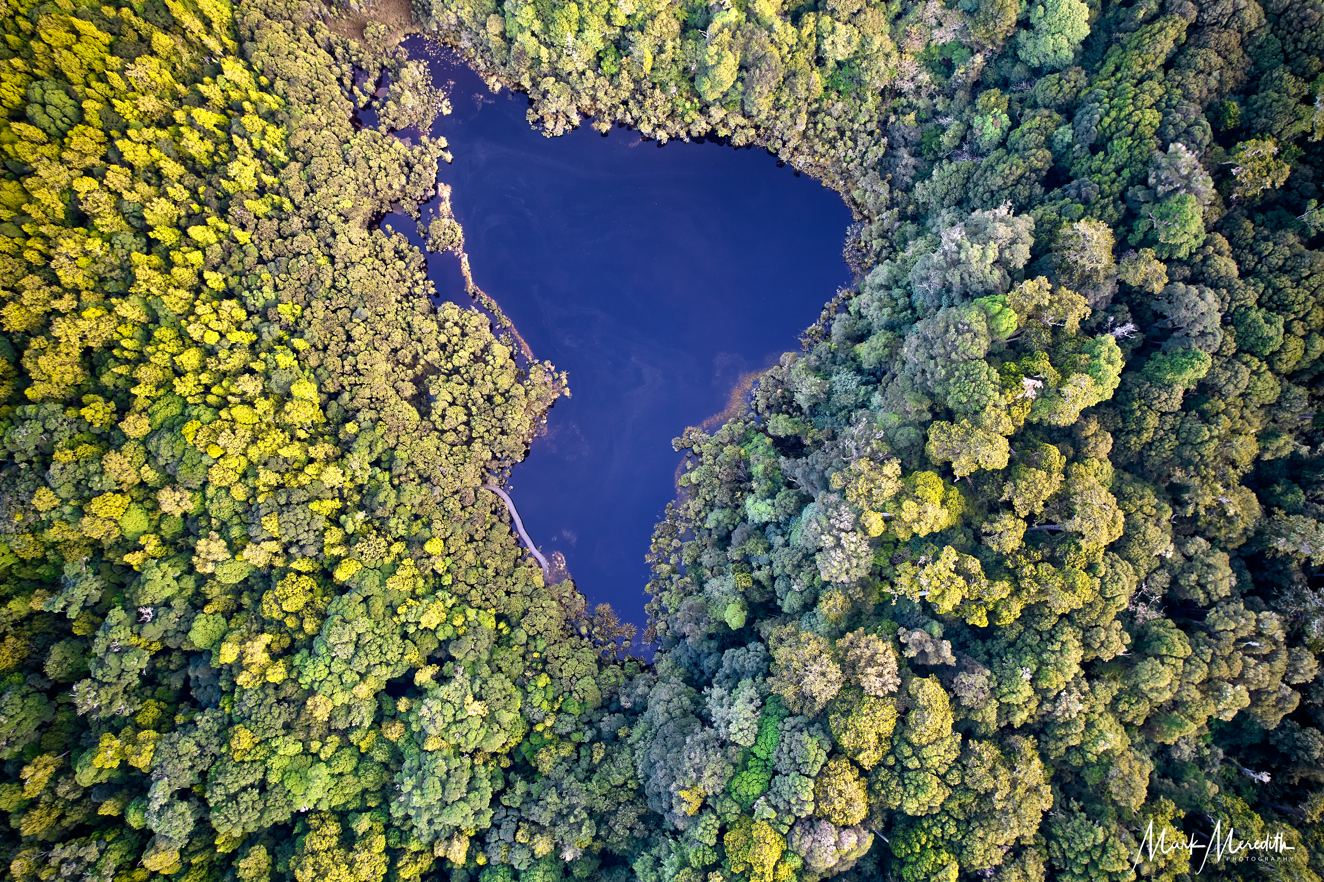
Hidden in forest from the main road at Tautuku Bay, and from the beach, is Lake Wilkie, a bog lake formed after the last ice age when water became trapped in a depression between ancient sand dunes and a cliff. Viewed from my drone it looks like the shape of South America surrounded by New Zealand native trees. Nearby, but closed in winter months because of dangerous tides, are the Cathedral Caves, impressively large chambers hollowed from tall cliffs where the pounding ocean echoes around you.


Our next overnight stop was south of Waiwaka at Curio Bay, in a comfy beachouse overlooking Porpoise Bay. With its stunning beach Curio Bay caters almost exclusively to holidaymakers, comprised of just a few dozen holiday homes, guesthouses and a campsite. In winter it was deserted.
Curio Bay is best known as the site of a petrified forest, some 180 million years old, which you can examine at low tide. It also hosts a yellow-eyed penguin colony, arguably the rarest of all the penguin species. And no, we didn’t see any of them either.
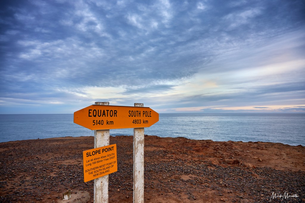
At this stage of our Catlins journey we had almost reached the most southerly point of mainland New Zealand. That exact spot is a short drive away at Slope Point. Take a selfie by the signpost pointing at the equator north and Antarctica the other way, where the next landfall is indeed the icy continent.
The cliff on which the sign stands by a small lighthouse beacon feels very isolated, reached by a 15 minute walk through fields from the car park. Nearby a group of macrocarpa trees have been blown, buffeted and shaped in extraordinary fashion by near incessant gales.
It’s a reminder, if one were needed, of how the great Southern Ocean, its winds, weather and tides, dominate evert facet of life in this far flung corner of the globe. This is brought home when visiting Waipapa Point Lighthouse, the next stop of note and which ends the Catlins section of the road trip.
Waipapa Point Lighthouse stands on a promontory of wave lashed coastline, its white paintwork gleaming in winter sunshine amidst grassy sand dunes above rocks where flocks of terns and gulls wheel and screech on the wind.
The lighthouse was completed 1884, built in response to the wreck of the passenger steamer Tararua on reefs off Waipapa Point in April 1881. It claimed 131 lives. Today it is fully automated. This is also a great place to see sea lions. Allegedly.


Heading west it seemed quite disconcerting to find ourselves back in the present, such is the effect of suddenly encountering speeding traffic, busy intersections, thundering lorries carrying cattle, sheep or logs after days of near solitude in the Catlins.
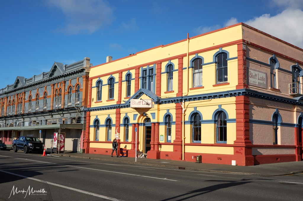
We decided not to stop in Invercargill, but to detour to Bluff, against the advice of my brother-in-law who insisted that “Bluff is the worst place in New Zealand”. Which just shows why you shouldn’t listen to family and follow your instincts.
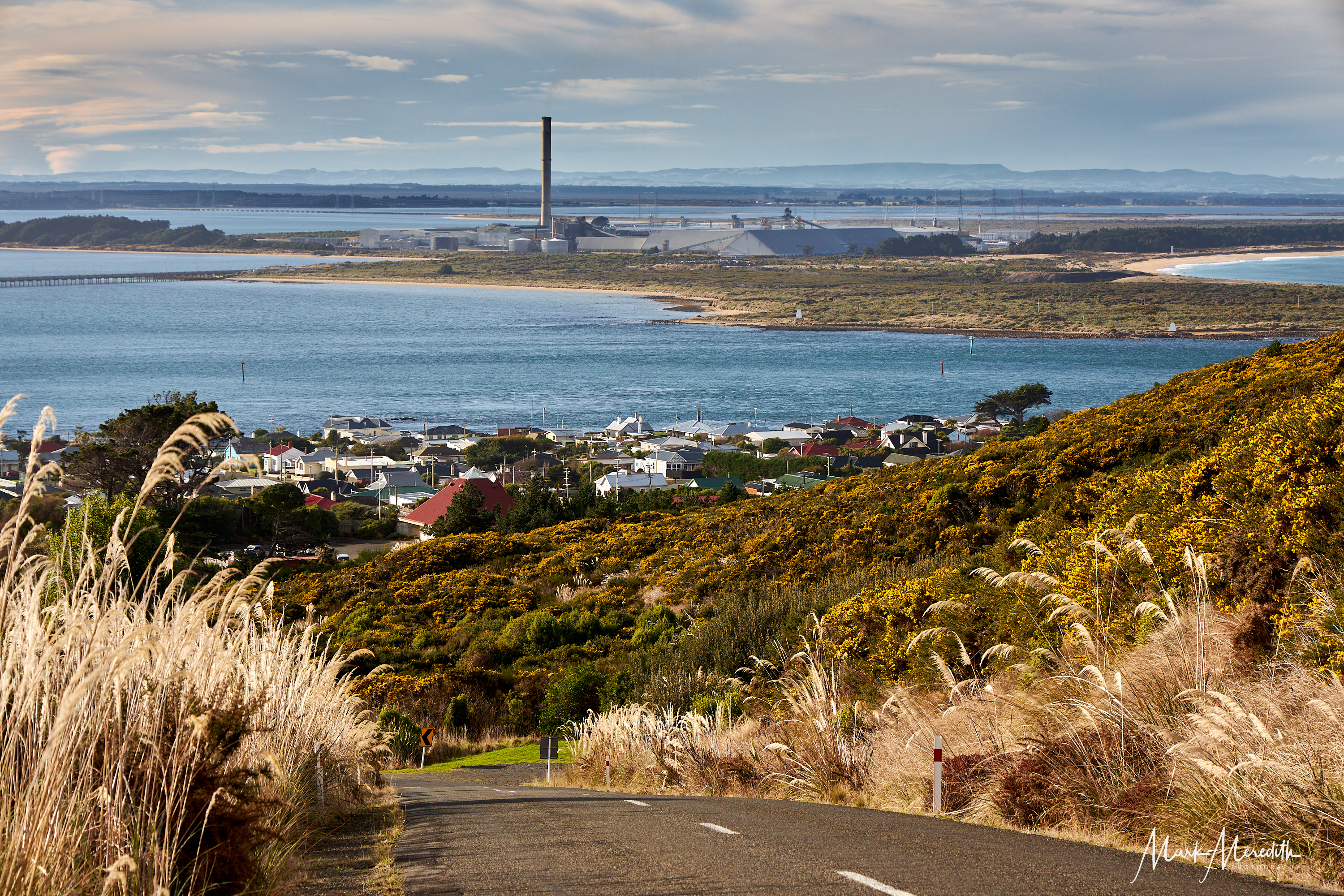
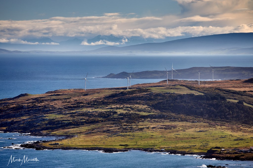
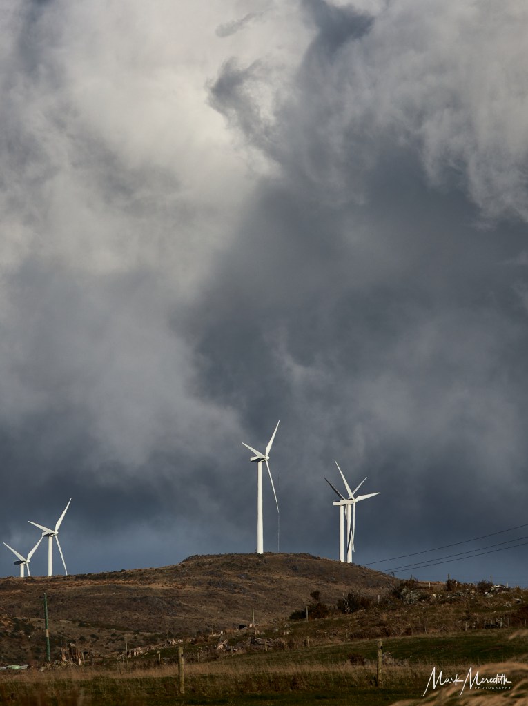
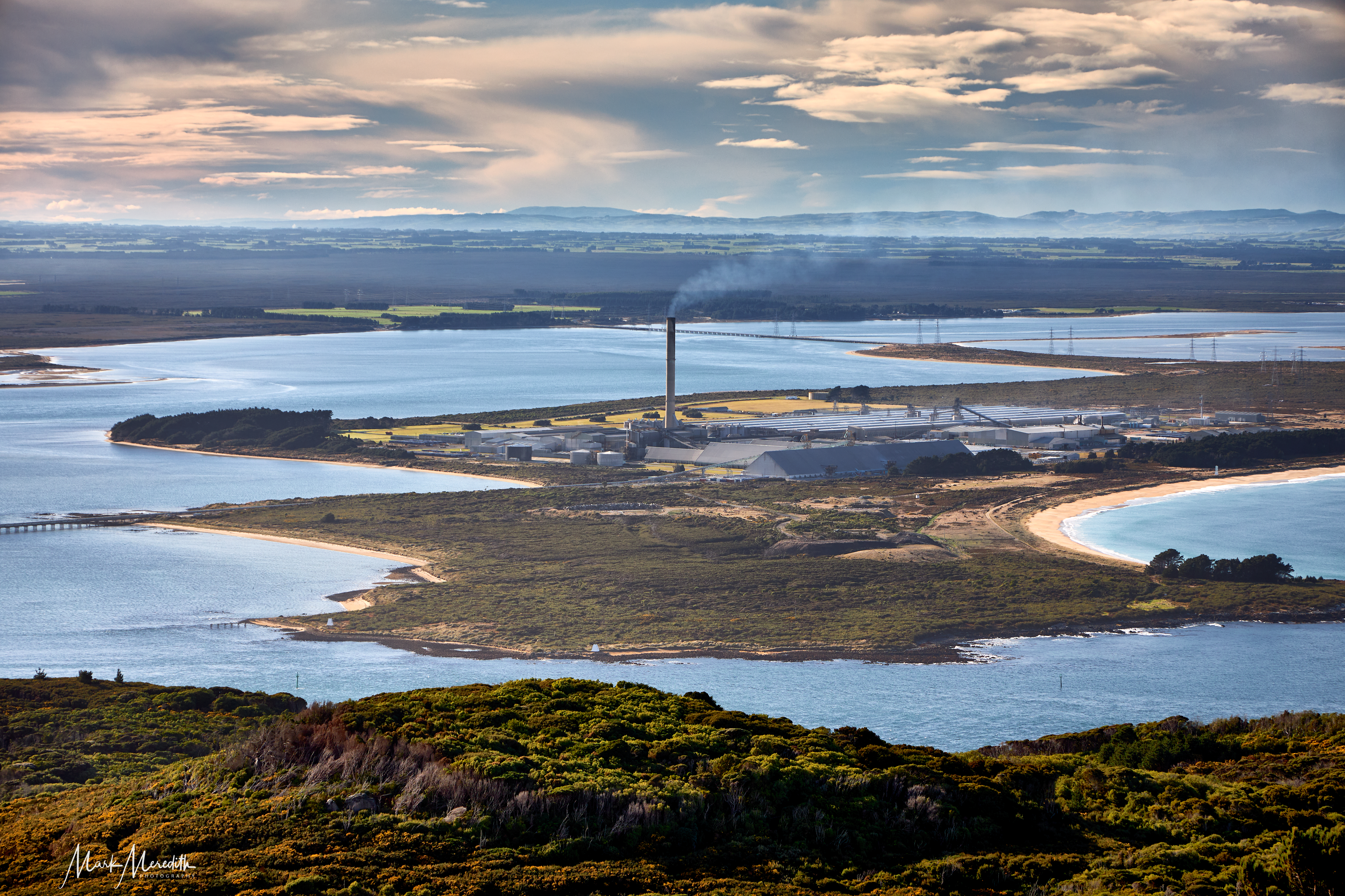
Bluff is a historic port town directly south of Invercargill famous for three things: its oysters, its Ostrea chilensis reputedly being the world’s finest example, celebrated with an annual oyster festival; as the gateway to Stewart Island/Rakiura, the true southern point of Aotearoa; and for the Tiwai Point aluminium smelter, the single largest consumer of electricity in New Zealand.
The smelter, owned by Australian mining conglomerate Rio Tinto, is powered by a hydro plant at Lake Manapouri in Fiordland (which we’d see later) hundreds of miles away, the creation of which kickstarted the environmental movement in Aotearoa in the 1960s and is a story of its own. The smelter is also the region’s largest employer.
We found Bluff in the sunshine charming, with very friendly people, brightly coloured murals and period buildings, sturdy houses climbing Bluff Hill made of brick and stone, no doubt built to withstand the winter cold, a rarity in the “shaky isles” of New Zealand where wooden frames and plasterboard are the norm. The views at the top of Bluff Hill are fantastic, sweeping south to Stewart Island, west to the distant snowcapped peaks of southern Fiordland, and east over the enormous smelter plonked on the end of Tiwai Point peninsula.
Bluff has a significant fishing industry, apart from its oysters. Stand for any length of time by the directional sign showing the town’s distance from geographical points around the world, and you’ll see a succession of fishing trawlers heading in and out of port. I can honestly say that my fish and chips lunch that day was among the finest I’ve ever enjoyed. I got a pensioner’s $10 special, even though I told them I hadn’t yet reached.


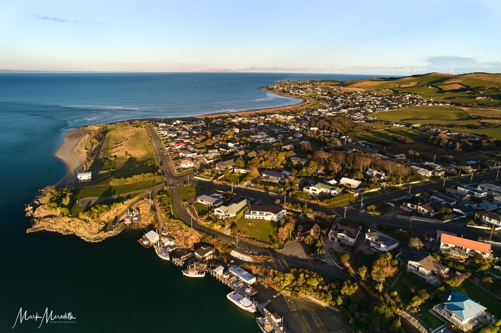
That afternoon we reached Riverton/Aparima, our last south coast overnight stop, about an hour from Bluff through farming country. The attractive town straddles an estuary formed by the confluence of the Aparima and Pourakino rivers which leads through a narrow outflow channel into Foveaux Strait.
Riverton is known as the oldest oldest Pākehā (European) settlement in Southland and Otago. It has a highly regarded Te Hikoi Southern Journey Heritage Museum telling the settlement story of Maori and Pākehā in the southlands. Unfortunately, it had just closed before we arrived.
I sent up the drone from the estuary shoreline next door to get an overview and found Riverton more extensive than immediately apparent on arrival. The late afternoon sunshine showed off the town at its prettiest, houses rolling over undulating coastal hills. From on high I saw rowers sculling on the estuary, fishing boats being readied for bed, and a rugby game played by elongated shadows on a field by the river mouth.
At sunset we took a drive to Howell’s Point Reserve on the edge of town where hundreds of seabirds gathered on guano stained rocks, flocking and flapping against the dusky sky and looming backdrop of Stewart Island on the horizon. The wind freshened from the icy south, raw and bracing, spitting freezing raindrops, driving us back to the car.


Morning broke still and freezing, the sun popping up over a river of mist blanketing the estuary. The guesthouse owners’ dog, left outside in an icy kennel overnight, was overjoyed to see us but we had to disappoint him. The day marked the climax of our entire SSR odyssey, a two night cruise on Doubtful Sound in Fiordland National Park.
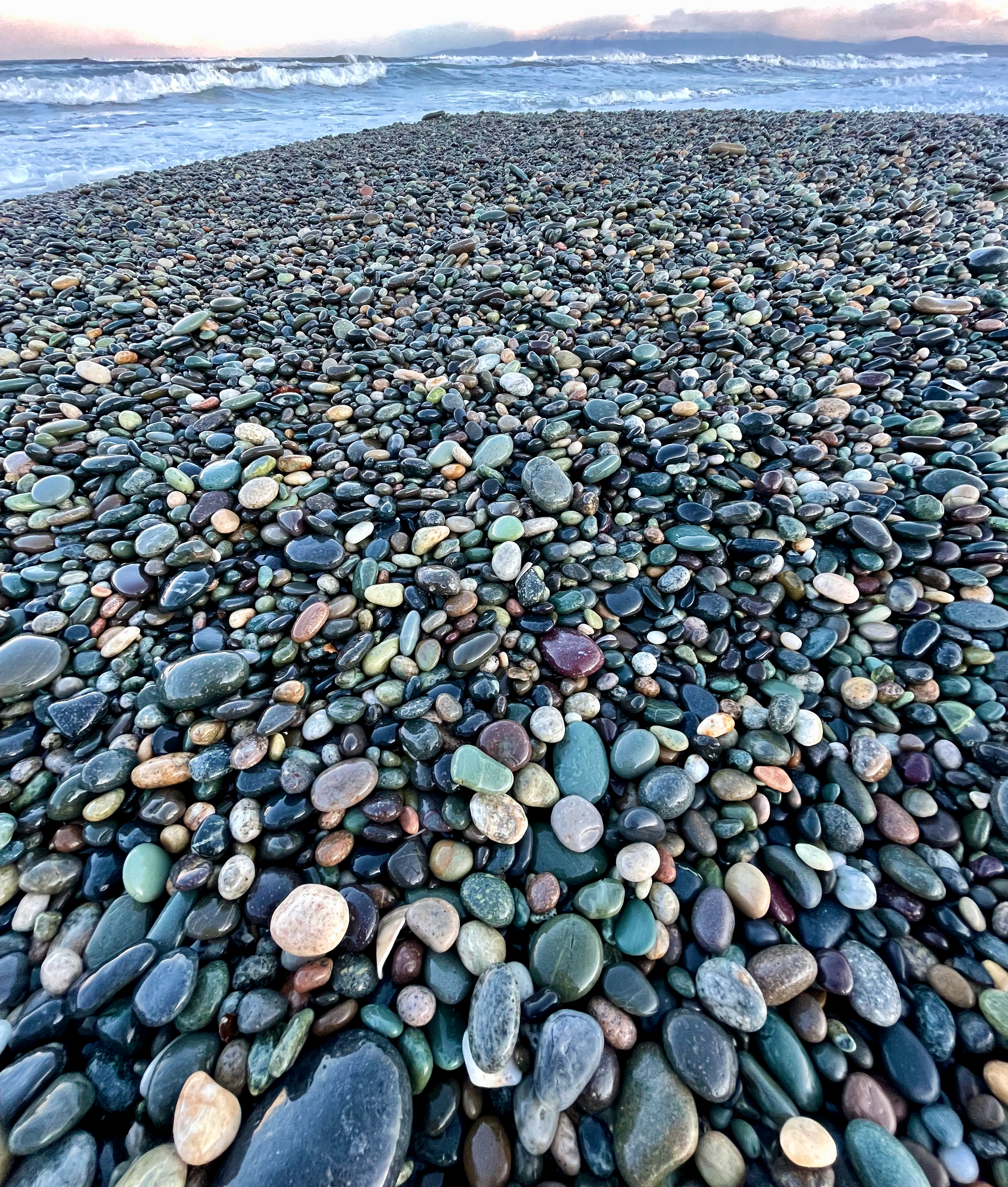
Leaving Riverton and heading north stop at Gemstone Beach at Orepuki. Here, the waves roll powerfully in from the Southern Ocean along with freezing wind. It’s a well known surfing location, but its greater claim to fame is the rainbow coloured pebbles and semi-precious gems churned up and deposited by the surging tides: garnet, jasper, quartz and nephrite can be found by keen fossickers. But it was too freezing for our fingers to fossick anything for more than a few minutes.


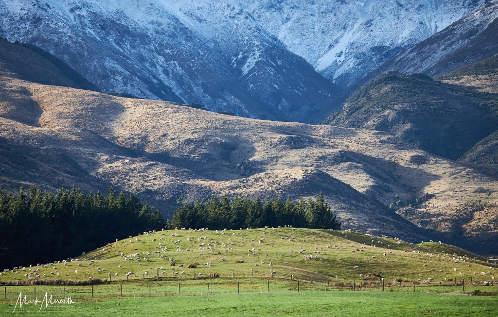

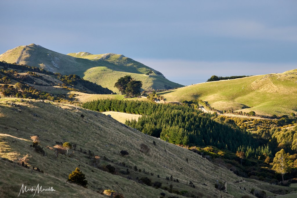
We headed two hours north, through classic New Zealand mountain scenery of snow dusted summits and valleys of sheep grazing on emerald green grass to Manapouri and our

Getting to Patea is part of the fun. The first leg of the journey is an hour’s scenic cruise across Lake Manapouri to the Manapouri hydro power station. At the terminal, past a battalion of overhead power lines, there’s a model of the gargantuan engineering feat, built into a mountain, that provides electricity to the Tiwai Point aluminium smelter in Bluff we’d seen the day before.

The Manapouri Hydro Station, which powers Tiwai Point Aluminium Smelter on Bluff, was planned in the late 1950’s. It originally called for the level of Lake Manapouri to be raised by 30 metres causing a mass outcry at the impact on the fragile environment. The Save Manpouri Campaign was launched heralding the birth of New Zealand’s environmental movement. In 1972 Prime Minister Norman Kirk announced the lake levels would not be raised. This massive hydro engineering project, seven years in the making, opened in 1971
Then onto a coach to travel over the snowy, slippery Wilmot Pass, New Zealand’s most expensive ever road, to our ship’s departure point at Doubtful Sound’s Deep Cove. The road winds over mountains, where the drop-offs looked extreme in parts, and cost $2 per cm to build in the 1960s. The commentary from driver Reynold was informative, and funny: “If you see oxygen masks pop out from the locker above you, we are in deep shit.”
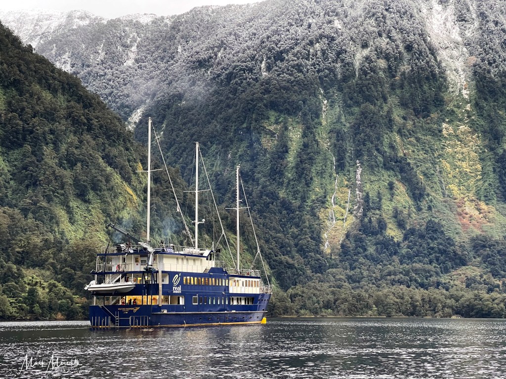
Doubtful Sound, or Patea, meaning “Place of Silence”, is one of the most isolated places in New Zealand. The packed lunch we received on the first day of our two night cruise came in a box decorated with a map of Doubtful Sound with a label reinforcing the message of loneliness: “Possibly the REMOTEST PLACE you’ll have lunch.”
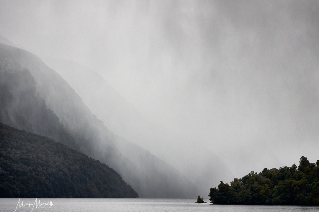
Doubtful Sound was certainly the wettest place I’ve eaten lunch. For days prior to our Real NZ cruise, I had anxiously been tracking Met Service. It continued to give us the same uncompromising message: torrential rain for Fiordland. It turned out that the sounds are best seen during downpours for their dramatic effect.
In Doubtful Sound rain volume isn’t measured in centimetres but multiples of metres. When it pours, which it does here over 200 days a year, Patea opens its lungs and sings the songs of waterfalls in a chorus that vanquishes the silence.
Waterfalls that didn’t exist the day before appear on cue: powerful cascades tumble down cliff faces with a sound somewhere between gentle harmony and wild exultation. As the rain dissipates, so the waterfalls dwindle, sometimes disappearing altogether, their singing turning sotto voce. Within hours you’d never have known they were there at all.


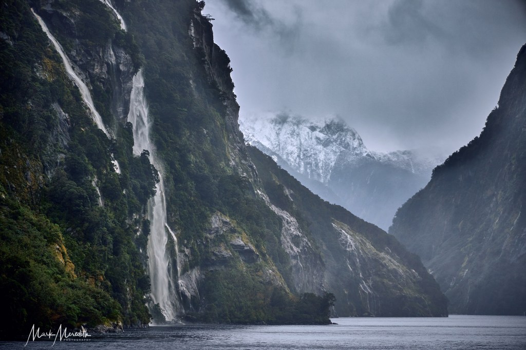

Only when the rain has long stopped and the remaining waterfalls flow with residual moisture does Patea live up to its name. A boundless silence fills Patea, all 40 kilometres of its towering, glacially carved valleys and the fiords that branch off it.
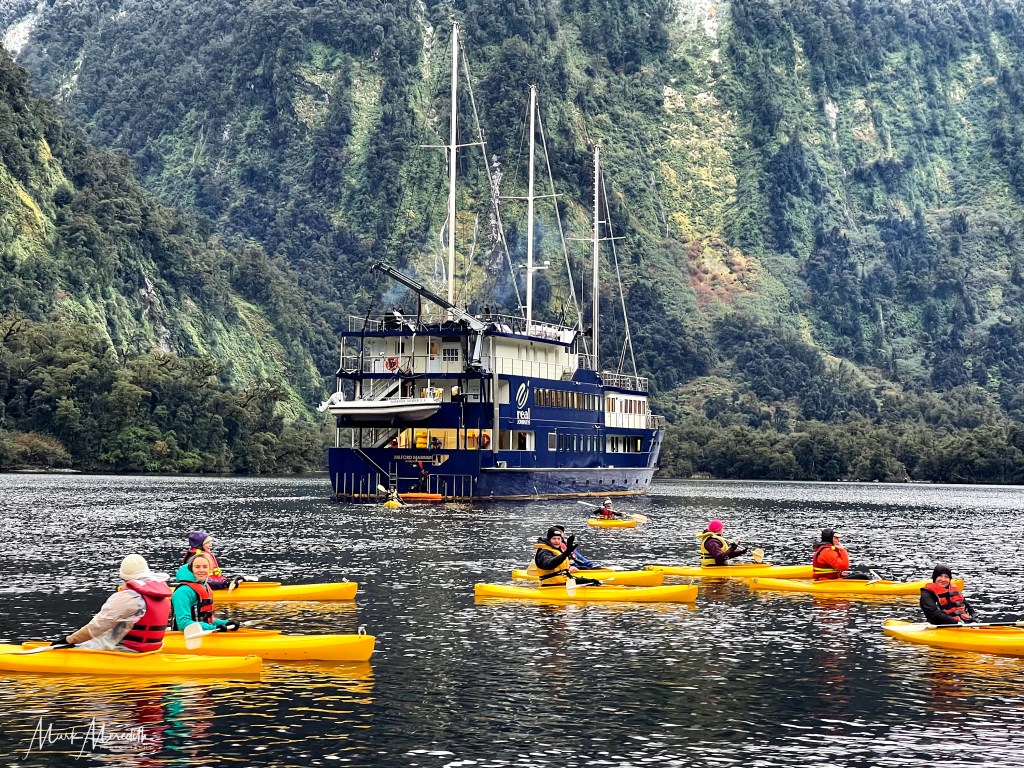
We had the option to enjoy the quiet in a less regimented way by hopping into a kayak and paddling away from the rumbling mothership; letting that soundless stillness envelop us. Even so, the sound of water never really went away. A sudden squall sent freezing horizontal rain and wind sweeping down the valley into the faces of the returning kayakers.
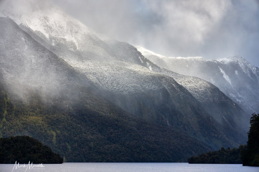
At Crooked Arm, a 14km fiord that branches off Doubtful Sound with pointed 1000 metre-plus, snow-capped mountains that rise steeply in symmetric poetry from the water, the dramatic scenery is perhaps the best of the whole voyage. But around every corner of every fiord a spectacle awaits.
We filled the Milford Mariner to half its 64-passenger capacity. With 30 guests on board the comfortable and beautiful three-masted ship, built in 2000 in the style of an old-fashioned scow, we were well fed and marshalled by a friendly, efficient and informative crew. And we were fortunate to be beneficiaries of a trial two-night winter special that cost less than the normal price of a one-night package.
While it was freezing, at a high of 4C, and quite uncomfortable on deck in the wind and slanting rain as I tried to keep the numb ends of my mittened fingers functioning and my camera dry, I would not have wanted it otherwise. Balmy breezes, sunny skies and summer in the sounds? No way!


After our adventures on Doubtful Sound we headed to Queenstown and the end of the SSR. That terminates beneath the jagged, snow-capped teeth of The Remarkables mountain range on the resort city’s outskirts. An apt place to end a remarkable road trip.
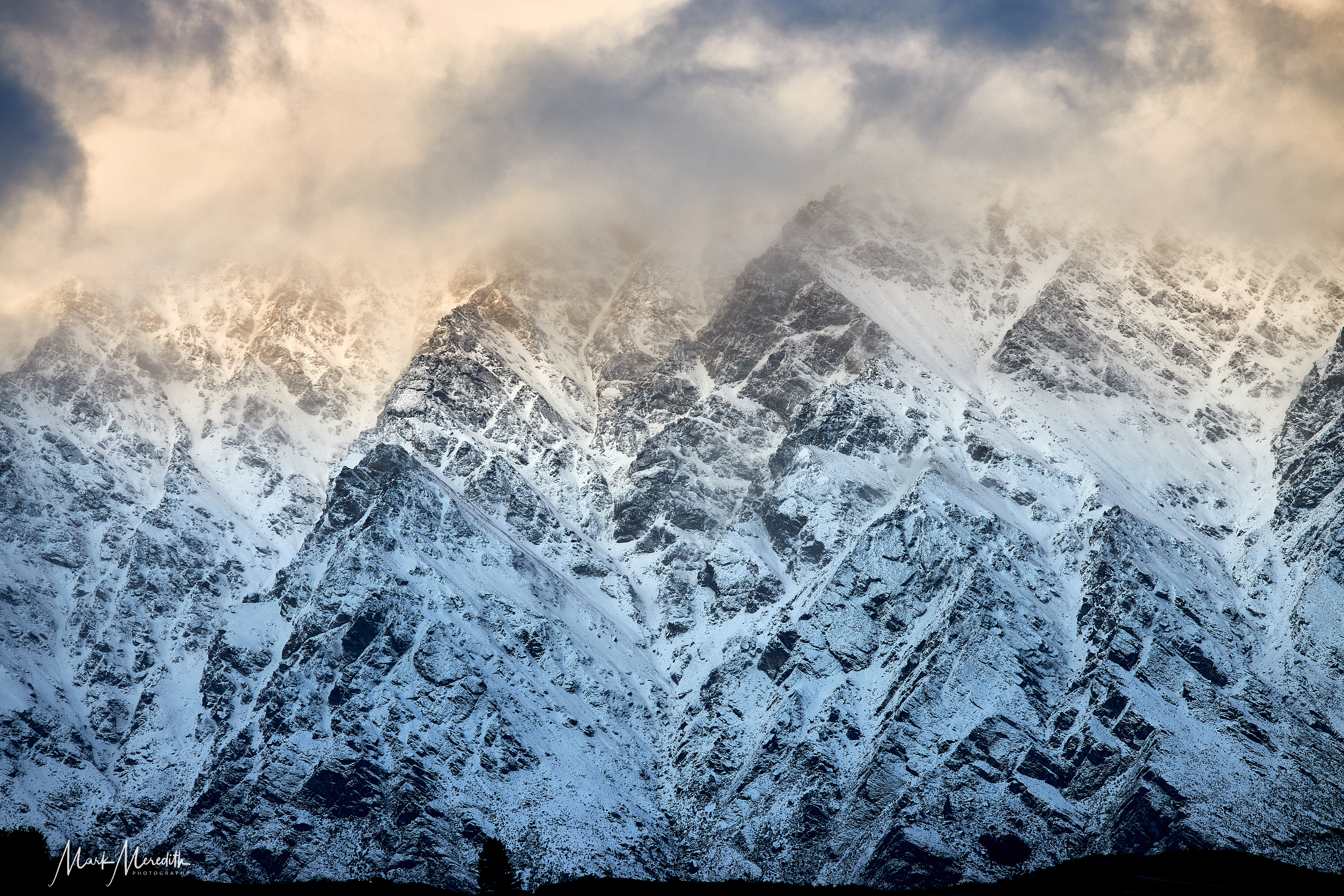
This was our fifth visit to Queenstown and it never disappoints, even in bone-chilling cold and bursts of freezing rain and sleet. We headed to the perimeter track of Lake Wakitipu by Queenstown Golf club to take in a windy, icy sunset over the snow-covered mountains.
At the shoreline, gazing out over the choppy waters of Lake Wakitipu towards Cecil Peak, we found an extraordinarily sculpture. The Wakitipu Witch stands four metres tall, face to the wind, braids of hair like the mythical Gorgon blowing out behind her. The Witch had me in her spell, just as our journey at the ends of the earth had surely done.

