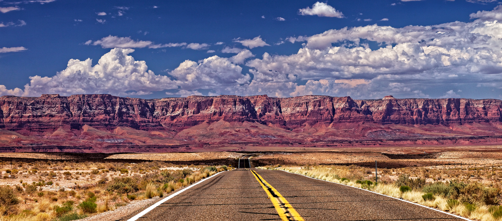
To get from the South Rim of the Grand Canyon to the North Rim you must drive for about four hours, 215 miles. If you were a bird you need only flap 10 miles from one side of the canyon to the other. But then you would miss out on the road between the rims and Vermillion Cliffs National Monument, the most striking feature on a never less than fascinating road trip.

In July, as part of a much longer road trip through California, Arizona, Utah and Nevada, we visited both rims of the Grand Canyon. After the extravagant spectacle of the South Rim, you might think that a four hour trip through the desert in temperatures in excess of 100F would be mundane and uncomfortable. Not in America. Wonderful, smooth roads in an air-conditioned SUV makes for a great drive. This was the landscape of so many western movies I grew up with, Apache indians in a red landscape under big skies. We came upon a flag fluttering in the hot desert wind of Geronimo, the legendary Apache chief, above a wooden stall selling Navajo and other indian jewellery and trinkets. We passed many indian roadside stalls in the baking desert heat, all competing with each other to scrape a living from passing tourists. At most stalls we saw tourists and I wondered what sort of living the indians did indeed make. The overall impression was that they lived in dirt poor conditions in an unforgiving landscape, their own “reservation”. I thought of the westerns and the way the indians were depicted, being shafted by the white man who spoke with ‘forked tongue”. I wonder how much has changed.

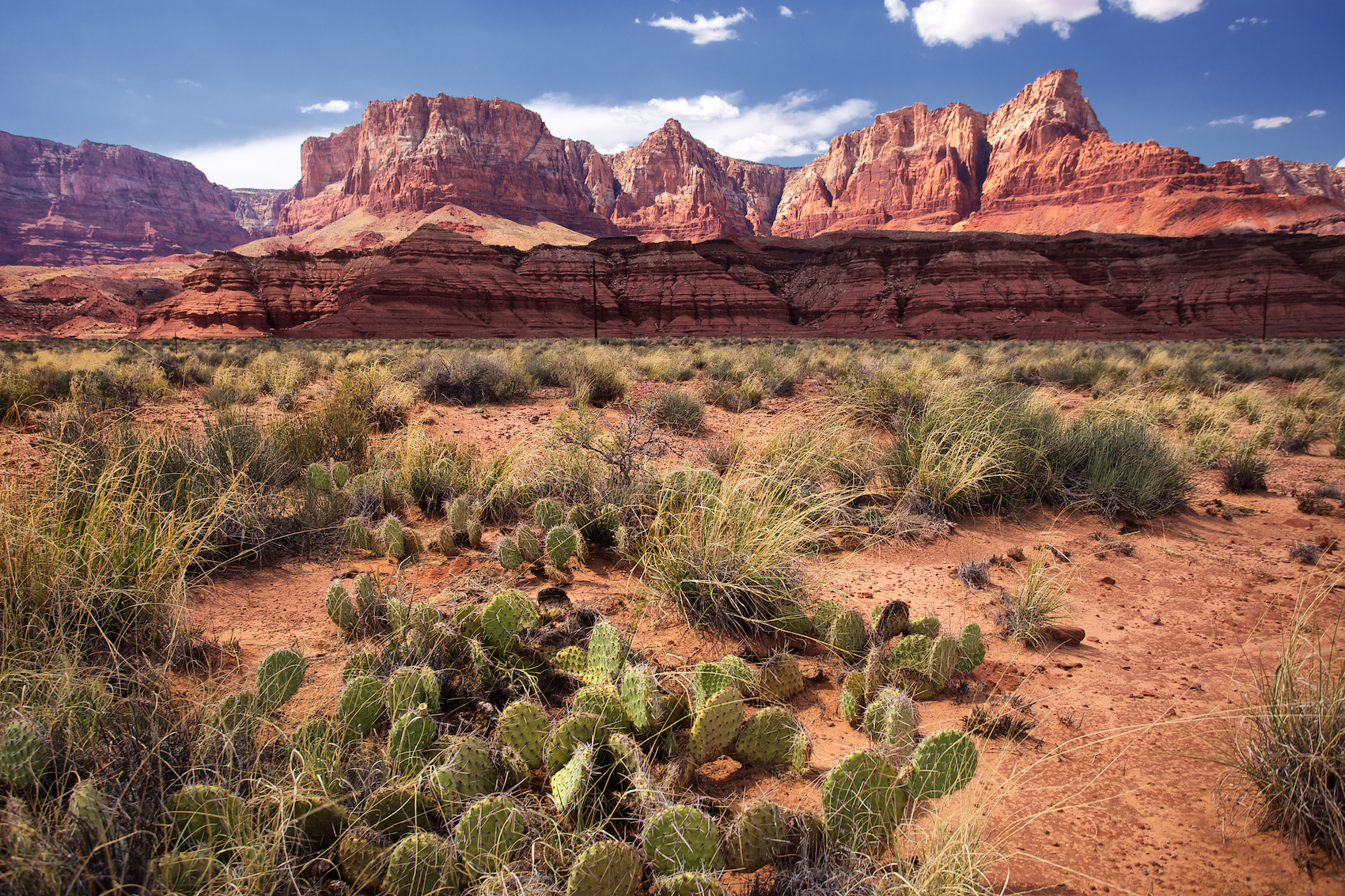
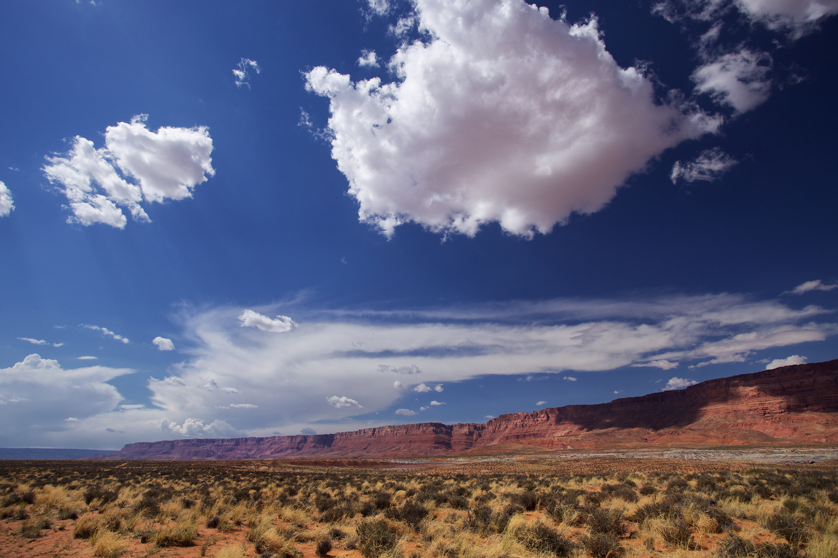
About an hour or so into the journey Vermillion Cliffs appears through the heat haze, a red wall 3,00ft high running across the flat, arid landscape; a deep burnished red exaggerated through my polarised sun glasses against an azure sky dotted by white, puffy clouds marching away to infinity. Some clouds take on a pinkish, red tinge reflected from the ancient rocks below. The closer you drive the less like a wall the cliffs appear. Instead, the cracks and fissures and crumbling sandstone faces hint at the massive geological upheavals which have shaped this extraordinary part of America. It seems an unbearably harsh place.
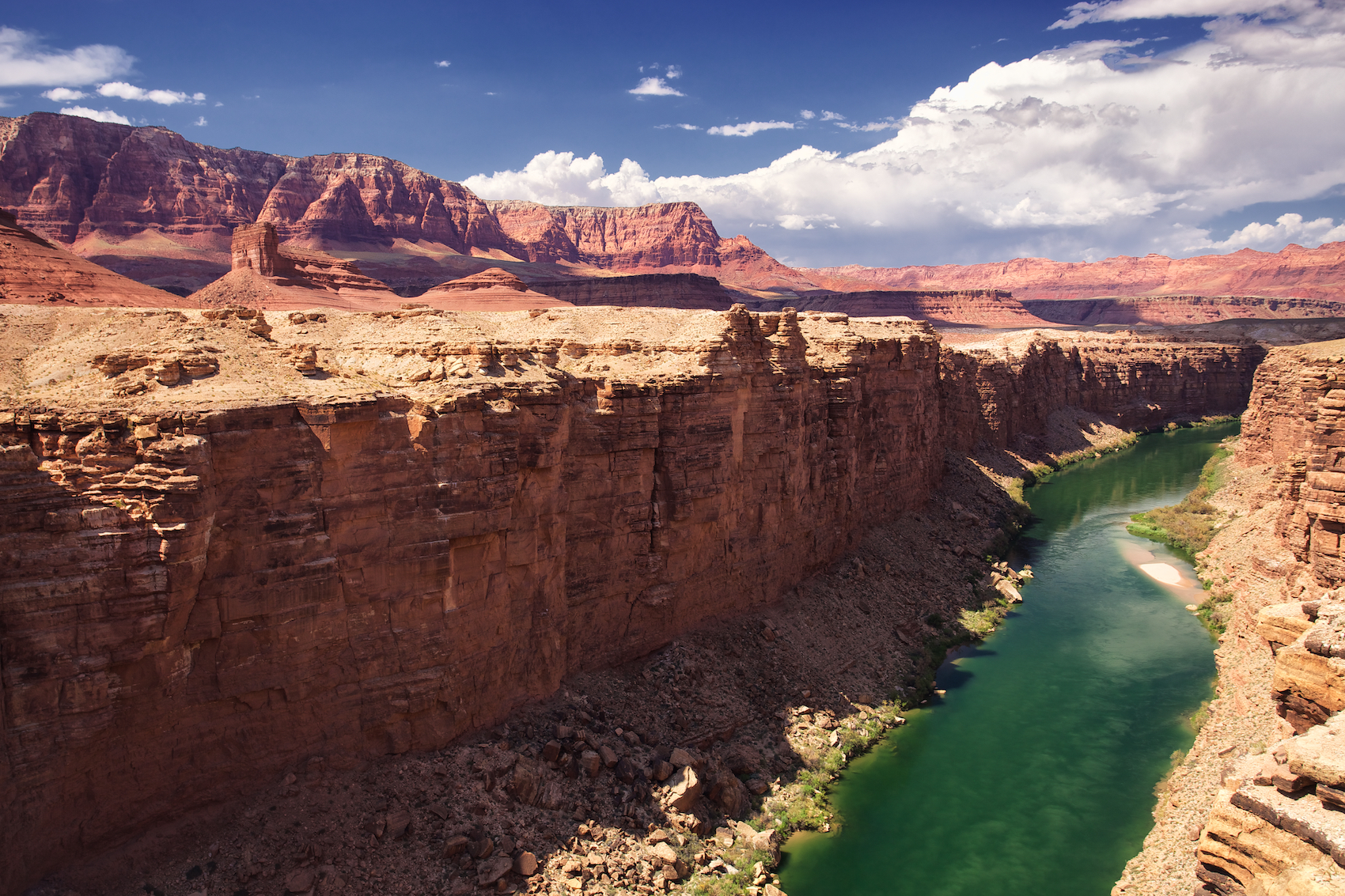

At the Navajo Bridge which straddles the blue/green Colorado River, we left the air conditioned comfort of our vehicle to walk on the bridge in temperatures now topping 110F. Along the roadside Navajo indians continued a brisk trade in a series of stalls swept by a baking desert wind. An American lady grabbed me by the arm and excitedly tried to show me a condor apparently perching on the bridge struts. All I could see and feel was the heat.


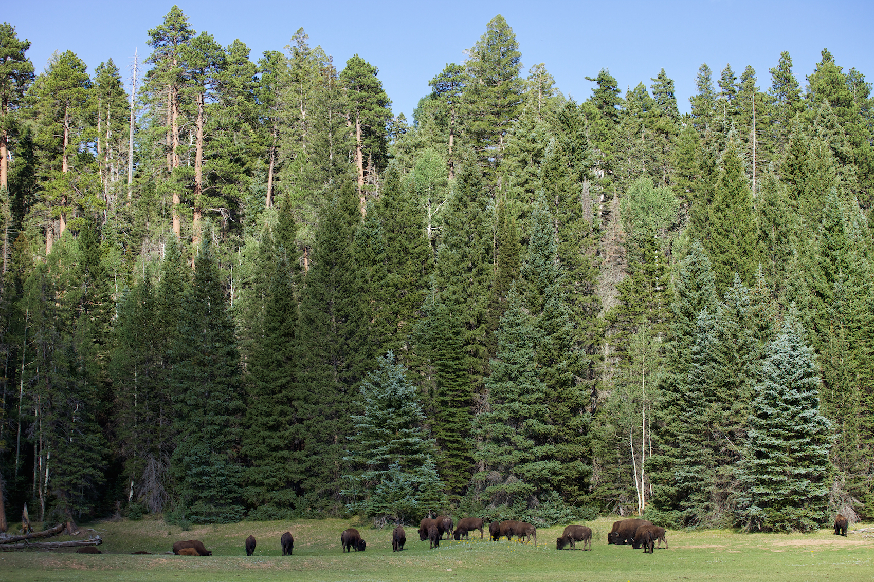
Travel east and you would reach Page and the Glen Canyon Dam and recreational area, and the beautiful if overcrowded Antelope Canyon — I vowed to visit this much photographed slot canyon another time. We headed west and climbed up towards the Kaibab Plateau which brought us to the Kaibab National Forest of aspens, ponderosa pine, juniper, spruce and the temperate relief of the Grand Canyon’s North Rim.